A synoptic survey of springs in the Driftless Area of Minnesota to identify spatial patterns in groundwater quality
What: This Gateway Project will introduce students to karst geology and hydrogeology in the Paleozoic bedrock landscape of the Driftless Area in southeastern Minnesota. Students will conduct a synoptic “snapshot in time” survey of springs across the region, with the goal of identifying key controls of groundwater quality.
When: July 29 – August 30, 2024 (tentative)
Where: Carleton College in Northfield, Minnesota (summer), GSA Annual Meeting in Anaheim, CA (September, 2024)
Who: Five students, a peer mentor, and project director Dr. Chloé Fandel (Carleton College, cfandel@carleton.edu)
Prerequisites: No courses beyond an introductory-level geology course are required. However, students will need to be physically able to hike and wade across rough terrain, be outdoors in hot, humid conditions during long field days, and be able to carry a full daypack with instruments and sample bottles. Students will be living in close quarters with other students (shared bunkrooms, bathrooms, common spaces, & kitchen). Students must also be willing to contribute to meal preparation and cleanup, and be somewhat flexible in terms of dietary preferences since the group will be eating shared meals. Most food allergies/preferences can be accommodated (e.g. vegetarian, gluten-free, halal, etc.), but students with severe allergies should be aware that the kitchen spaces and utensils will be shared.
Expectations and Obligations:
1. Participation in all project-related work during the summer (5 weeks)
2. Submission of an abstract (individual or in groups) and presentation of a paper (poster or talk) at the Geological Society of America National Meeting in Anaheim, CA in Fall 2024 (all expenses covered).
PROJECT DESCRIPTION
Overview
This Gateway Project will introduce students to karst geology and hydrogeology in the Paleozoic bedrock landscape of the Driftless Area in southeastern Minnesota. Students will conduct a synoptic “snapshot in time” survey of springs across the region, with the goal of identifying key controls of groundwater quality. For a subset of springs, students will also collect water samples for stable isotope and tritium analysis to determine groundwater age and provenance. Springs are excellent hydrogeologic indicators because they integrate everything that happens in the springshed above them. They are also sites of high ecological, cultural, and economic significance. The results of this survey will therefore be of broad interest to many stakeholders in the region (drinking water quality managers, farmers, cultural and ecological preservation and advocacy organizations, trout fishing groups, etc.).
Geologic Setting
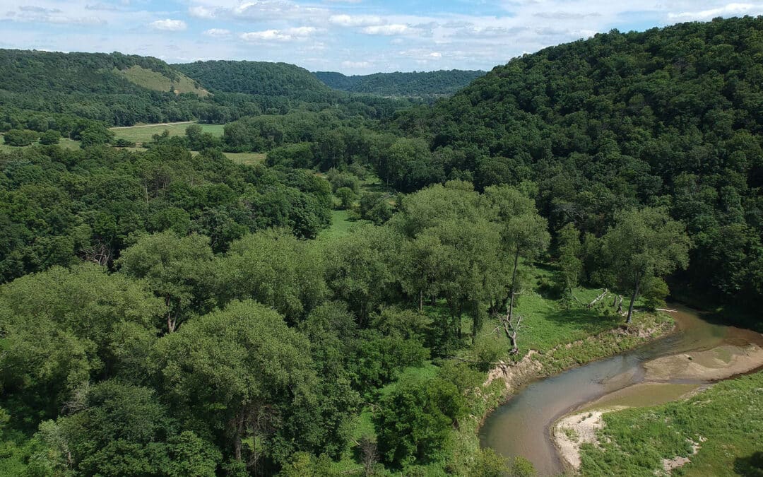
The Driftless Area is a topographically distinct region of the Upper Midwest lacking the thick cover of glacial deposits that is typical in the surrounding areas. It is made up of the “true” Driftless Area on the eastern side of the Mississippi River Valley (Wisconsin and northern Illinois), which was never covered by an ice sheet, and an area of “Driftless-style” topography on the western side of the Mississippi River Valley (Minnesota and Iowa), which, though topographically and geologically very similar, experienced pre-Illinoian glaciation between 500,000 and 2,600,000 years ago and therefore contains some sparse, patchy remnants of glacial deposits and landforms (Carson et al. 2023). The region overall is characterized by steep forested hills, deeply incised river valleys, and well-developed karst systems feeding numerous springs and coldwater streams. The Paleozoic bedrock is widely exposed at the land surface and consists of gently dipping sedimentary layers recording cycles of marine transgression and regression. This geologic and geomorphologic setting gives rise to delightfully complex hydrogeologic systems, with alternating layers of clastic aquifers, carbonate aquifers, and fine-grained aquitards, all cut by systematic regional jointing and by the incised topography (Runkel et al. 2003). Extensive agricultural activity and rapid flowpaths through solutionally enlarged karst conduits make the region highly vulnerable to groundwater contamination, which has been an ongoing problem (Alexander et al. 2013). Springs, as described above, are ideal sites to investigate groundwater flow patterns and contaminant transport mechanisms in the area.

Figure 1: Map of springs in the Driftless Area of southeastern Minnesota. The inset shows the relative location in North America and the main map shows the bedrock geology and spring locations within the study region. Black dots mark relevant sites for this study: Carleton College and the town of Preston, where students will be based, and two large caves in the region, which are connected to significant spring systems.
Previous Work
Existing research in Minnesota and Wisconsin has laid a strong foundation for this proposed project: both states have public inventories of spring locations (with varying degrees of additional data) (Swanson et al. 2019, MN Department of Natural Resources 2017), as well as numerous detailed studies of individual springs (e.g. Barry et al. 2020, Luhmann et al. 2012). One significant gap that emerges from the body of existing work is the lack of synoptic data across springs: data collected within a narrow time window of baseflow-dominated conditions. Because spring flow rates, temperature, and chemistry can vary in response to precipitation events and can evolve over years or decades, data collected during different years or seasons is of limited use. To obtain the clearest groundwater signal, with minimal influence from surface water, springs must be surveyed during a short window of a few weeks, either during the late summer dry period, or during the coldest weeks of winter when temperatures are consistently below freezing.

Figure 2: Students recording electrical conductivity and temperature at a spring during a preliminary site visit in the summer of 2023.
Potential Student Projects
Hypothesis: The initial hypothesis we are testing is that the primary determinant of spring water quality is the average age of groundwater emerging from the spring, with land use practices within the springshed having a larger impact in springs with younger groundwater ages. This idea has been put forward in existing literature, but has not been systematically tested (Runkel et al. 2018). The data required to test this hypothesis are synoptic measurements of discharge, water quality, and groundwater age and provenance at springs across a range of stratigraphic positions and land-use contexts.
Students will work as a team to collect the shared data needed to test the project’s overarching hypothesis. Rotating groups of two students each will record the location, discharge, basic water quality parameters, and stratigraphic position of each spring, as well as taking water samples for analysis. During the last week of the project, students will split into three groups to explore three sub-questions using the shared data. The groups and sub-questions may shift in response to initial findings and student interests. The near-peer mentor will participate in all of these activities, but will also continue working on more in-depth analysis during the following academic year. All of the students will work together on the fourth sub-question.
Sub-question 1 (two students): What is the relationship between spring stratigraphic and topographic position and the basic water physical and chemical parameters collected in-situ? Parameters for consideration include discharge, temperature, pH, electrical conductivity, dissolved oxygen, and nitrate concentration.
Sub-question 2 (two students): What is the relationship between land use/land cover in a springshed and the basic water physical and chemical parameters collected in-situ? This will involve basic mapping using ArcGIS.
Sub-question 3 (one student and near-peer mentor): What are the primary sources of groundwater to the springs for which stable isotope samples were collected?
Sub-question 4 (all students and near-peer mentor): What is the relationship between groundwater age and basic water physical and chemical parameters collected in-situ?
Student Learning Outcomes
Participating in this project will introduce you to a range of geologic concepts, field skills, and scientific good practices, including how to:
➔ Formulate a testable hypothesis
➔ Identify and interpret surficial glacial landforms & karst landforms
➔ Identify local Paleozoic bedrock units
➔ Understand how local variations in topography, surficial geology, and bedrock geology influence the spatial distribution and chemistry of springs
➔ Assess the potential hazards of a survey site and make safe decisions about the best line of approach
➔ Select from and apply several different field techniques for measuring discharge
➔ Apply water sampling protocols for stable isotope and tritium analyses
➔ Apply basic spring characterization techniques, including using handheld GPS devices, calibrating and deploying pH, temperature, electrical conductivity, dissolved oxygen, and nitrate probes, and making high-quality sketch maps of spring sites
Once we have completed the data collection portion of the project, we will work in teams to interpret and communicate our findings. You will learn to:
➔ Assess data quality and perform basic statistical significance tests
➔ Visualize and query data using ArcGIS
➔ Interpret stable isotope and tritium analysis results
➔ Produce clear and informative figures
➔ Create a visually engaging poster and present it effectively
PROJECT LOGISTICS
We will conduct fieldwork over the course of five weeks in late summer of 2024, during low-flow hydrologic conditions. Students will present their findings at the GSA Annual Meeting in September 2024, in Anaheim, CA (see schedule below). Exact dates may shift to accommodate the home institution fall semester start dates for participating students.

Meals, lodging, and transportation: Students will stay in summer dormitory housing on Carleton’s campus during Weeks 1 & 5, and will have access to the campus dining halls. During Weeks 2-4, we will stay in rented summer camp cabins with shared kitchen space near Preston, MN, two hours south of Carleton, and centrally located with respect to the target springs to be surveyed. Students will be assigned chore rotations (grocery shop, cook, clean) in groups during the weeks in Preston.
Safety: Students will be driving to and from survey sites on a daily basis, and will be hiking off-trail through steep and sometimes heavily vegetated terrain, as well as occasionally wading along or across streams. Roads are generally in good condition and 2WD accessible. However, cell service in the incised valleys where most springs are found is unreliable. We will devote part of Week 1 to field navigation and safety training, using a local wilderness area approximately ten minutes from campus. Training will include basic map, compass, and GPS navigation skills, choosing a safe path through steep terrain, determining whether a river is safe to wade across and practicing wading techniques, and basic field first-aid. Students will always work in rotating teams of two, and will be provided with GPS devices. The near-peer mentor will be integrated into these teams, and the project director will work as a third member of a different team each day, so that teams assigned to more challenging locations can be accompanied by the project director or the near-peer mentor. We will begin each day with a meeting in which we go over each team’s planned itinerary for the day, and agree on planned SMS check-in times and return times. Students will also be given the option to check out field gear from the Carleton Geology Department (rubber boots, waders, daypacks, and rain gear) if needed.
References
Alexander, EC, Runkel, A, Tipping, R, and Green, J, 2013, Deep Time Origins of Sinkhole Collapse Failures in Sewage Lagoons in Southeast Minnesota: 13th Sinkhole Conference Proceedings, p. 285–292.
Barry, J, Miller, T, Steenberg, J, Runkel, A, Kuehner, K, and Alexander, EC, 2020, Combining high resolution spring monitoring, dye tracing, watershed analysis, and outcrop and borehole observations to characterize the Galena Karst, Southeast Minnesota, USA: 16th Sinkhole Conference Proceedings, p. 3–17.
Carson, E, Curry, B, Kerr, P, and Lusardi, B, 2023, The Driftless Area: The extent of unglaciated and similar terrains in Wisconsin, Illinois, Iowa, and Minnesota: Wisconsin Geological and Natural History Survey Educational Series Educational Series 057.
Luhmann, A, Covington, M, Alexander, S, Chai, S, Schwartz, B, Groten, J, and Alexander, EC, 2012, Comparing conservative and nonconservative tracers in karst and using them to estimate flow path geometry: Journal of Hydrology, v. 448–449, p. 201–211.
Minnesota Spring Inventory Guidance Document, 2017, Minnesota Department of Natural Resources.
Runkel, A, Tipping, R, Alexander, EC, and Green, J, 2003, Hydrogeology of the Paleozoic Bedrock in Southeastern Minnesota: Minnesota Geological Survey RI-61.
Runkel, A and Steenberg, J, 2018, Stratigraphic positions of springs in southeastern Minnesota: Minnesota Geological Survey OFR 18-2.
Swanson, S, Graham, G, and Hart, D, 2019, An Inventory of Springs in Wisconsin: Wisconsin Geological and Natural History Survey Bulletin, v. 113.