Investigating linkages between geologic histories, eolian dust production, and climate change
What: Increased drought frequency and severity combined with vegetation change is increasing dust emissions, which in turn affects snowmelt, groundwater, and nutrient transfer. This Gateway project seeks to better understand the sources and transport of dust in the San Luis Valley, CO, by asking: How does over a billion years of geologic history affect sand production, attrition, and transport from the western slope of the Colorado Sangre de Cristo Range?
When: June 17-July 19, 2024 (tentative)
Where: Colorado College, Colorado Springs, CO (summer), GSA Annual Meeting in Anaheim, CA (September, 2024)
Who: Ten students, a peer mentor, and project directors Dr. Sarah Schanz (sschanz@coloradocollege.edu) and Dr. Michelle Gevedon (mgevedon@coloradocollege.edu), Colorado College
Prerequisites: No courses beyond an introductory-level geology course are required.
Expectations and Obligations:
1. Participation in all project-related work during the summer (5 weeks)
2. Submission of an abstract (individual or in groups) and presentation of a paper (poster or talk) at the Geological Society of America National Meeting in Anaheim, CA in Fall 2024 (all expenses covered).
PROJECT DESCRIPTION
Goals: Increased drought frequency and severity combined with vegetation change is increasing dust emissions, which in turn affects snowmelt, groundwater, and nutrient transfer. Here, we propose a study to better understand the sources and transport of dust in the San Luis Valley, CO, by asking: How does >1 Ga geologic history affect sand production, attrition, and transport from the western slope of the Colorado Sangre de Cristo Range? In addition to these research goals, we anticipate the use of forensic geology and remote sensing to connect >1 Ga geologic history with modern climate change will provide students with an expansive view of modern geologic studies.
Significance
In snowpack-dominated regions such as the SW United States and including the proposed study area, meltwater sustains baseflows during the summer and is an important resource for agriculture, ranching, and recreation, not to mention for native flora and fauna. However, climate change and land disturbance are likely to substantially alter snowmelt timing and magnitude in the coming decades.
Of particular relevance in the arid valleys surrounding the Colorado Plateau is the effect of increased land disturbance, aridification, and eolian-transported dust on snowpack (Figure 1). Altered land use beginning in the 1800s has disturbed the native biologic soil crust (Warren and Eldridge, 2001). Biologic soil crust can prevent soil erosion by creating soil cohesion in the top layer and has been shown in modelling and field experiments to play a significant role in preventing soil erosion (Munson et al., 2011). Removal of biologic soil crust through introduction of large non-native bovines (Kauffman et al., 2022) and motor vehicle disturbance (Duniway et al., 2019) has increased soil erosion by eolian action (Warren and Eldridge, 2001). Land use changes have converted native shrublands to grasslands, which are more sensitive to climate change and thus more likely to experience enhanced eolian erosion in the coming decades (Munson et al., 2011).

Figure 1. Conceptual diagram of the human-dust-snowmelt feedback. Blue shows the conceptual realm of our proposed study and red are the implications of our study for the San Luis Valley, CO.
Eolian transport is also increasing due to aridification of the Western United States. Previously stabilized dunefields are likely to be reactivated due to devegetation and increased sand mobility caused by lower precipitation and higher evapotranspiration rates (Thomas et al., 2005). New sources of eolian dust may arise due to devegetation; for instance, warming temperatures and drought along the Colorado Basin is expected to decrease river flow by 30% by midcentury (Udall and Overpeck, 2017), which in turn will drive vegetation loss and lead to increased soil erosion by wind. Increased fire magnitude, related to drier climate conditions, will enhance wind erosion; post-fire wind erosion effects can last for up to 10 years (Duniway et al., 2019).
The aforementioned increases in eolian transport are leading to increased dust deposition on snow, which decreases the albedo and increases melt rates. Dust deposition in the western US has increased 5-fold largely due to changes in land use in the 1800s (Neff et al., 2008). As dust deposits on snowpack, the darker dust particles lower the surface albedo by half and results in increased radiative forcing (Painter et al., 2007). As a result, snow melt occurs earlier and the duration of snow cover is shortened by up to 35 days (Painter et al., 2007); by the end of the century, snow melt may occur up to 2 months earlier (Rauscher et al., 2008).
Earlier seasonal snowmelt due to dust emissions is a global problem; dust emissions have increased four-fold due to land use change in Tibet, based on Dasuopu glacier ice core records (Thompson et al., 2000), and dust deposition has doubled in Antarctica due to climate change and land degradation (McConnell et al., 2007). Here, we propose to quantify the sources of dust on a local scale in order to better understand the future of water resources in the San Luis Valley, CO, and examine how modern dust production is primed by geologic history.
Study Site
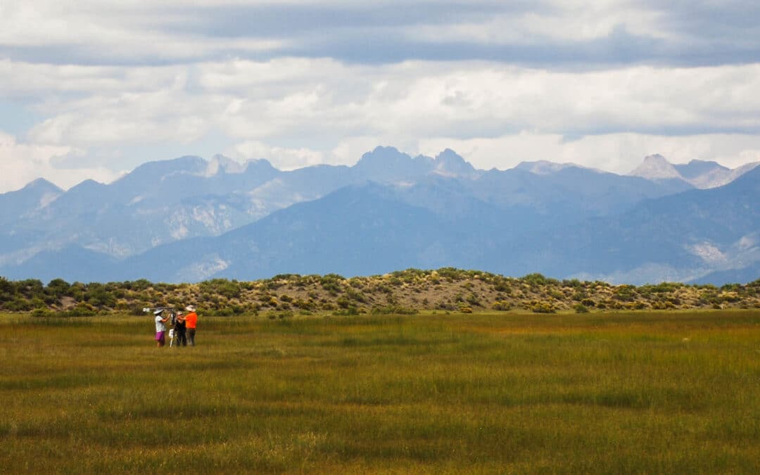
The San Luis Valley, CO, is an agricultural and ranching hub for Colorado and New Mexico that depends on snowmelt-derived water from the San Juan and Sangre de Cristo ranges (Figure 2). Recently, tourism has become an important part of the economy with notable attractions being the Great Sand Dunes National Park and wildlife viewing that includes sand hill crane migrations.

Figure 2. Maps of the northern San Luis Valley show A) land use on eolian deposits and B) general geology. The location of proposed work at Crestone, CO, is noted. Inset shows the location within Colorado State, US.
Eolian processes have shaped the late Quaternary surface geology that tourism and agriculture rely on; the eastern side of the San Luis Valley contains broad eolian deposits on which ranching, protected wildlife areas, and the National Park are situated (Figure 2A). The eolian sands are modern, but were primed by mid-Quaternary events. Pleistocene glaciers and rivers transported volcanic rocks from the San Juan Mountains on the west side of the San Luis Valley, depositing sand-sized fragments in a large alluvial fan (Madole et al., 2008). The presence of pluvial Lake Alamosa prevented eolian deposition until after 400 ka (Davis et al., 2017). Eolian sands are composed primarily of San Juan volcanic rocks, though 30% of the sand is sourced from the eastern Sangre de Cristo Range (Madole et al., 2008). However, the source rocks from the Sangre de Cristo range cover only 4.7% of the drainage area, compared to the 42.8% coverage of the San Juan volcanics (Tweto, 1979). Thus, by area, the Sangre de Cristo source rocks disproportionally comprise the eolian sands.
Our proposed work focuses on the Sangre de Cristo source rocks and seeks to understand how these sands are sourced and transported. The Sangre de Cristo range represents a wide array of ages from early Proterozoic gneisses to Permian conglomerates; each of these rock types will contain a unique geochemical fingerprint as well as unique physical properties that dictate the breakdown to sand-sized grains.
Geology
The Sangre de Cristo Range of Colorado is composed primarily of Pennsylvanian-Permian syndepositional sedimentary rocks that have been exhumed through Laramide thrust faults and Rio Grande rift extension (Figure 2B). Proterozoic crystalline rocks such as a quartz monzonite and gneisses are exposed along the Crestone Thrust fault, where they have overridden the much younger Ordovician to Permian sedimentary units.
The Pennsylvanian and Permian syndepositional sedimentary rocks of the Minturn and Sangre de Cristo formations represent alluvial deposits off the Uncompahgre uplift (Hoy and Ridgway, 2002). During this time, the modern location of the San Luis Valley and Sangre de Cristo Range was a basin draining the Uncompahgre uplift to the west. The Permian Minturn Formation is composed of fan-delta and fluvial delta facies of varied siltstones to conglomerates. The younger Sangre de Cristo Formation is frequently split into two members: the lower Sangre de Cristo and the upper Crestone Conglomerate member. The lower member is a conglomerate with facies representing stream deposits while the upper Crestone Conglomerate is a clast-supported, high energy deposit containing clasts of conglomerate, rhyolite, monzonite, and granite from an alluvial fan setting (Hoy and Ridgway, 2002).
Uplift along the Crestone thrust fault brought the Pennsylvanian and Permian sedimentary deposits in contact with older units, resulting in thin slivers of Ordovician – Devonian sedimentary rocks and Proterozoic gneisses and quartz monzonite along the western Sangre de Cristo rangefront. Proterozoic quartz monzonite is dated to 1.7 Ga and represents pluton emplacement during the Yavapai Orogeny, while the older gneisses likely formed in an arc setting during early orogenesis (Jones III and Connelly, 2006).
During the Laramide Orogeny, thrust faults on the east and west side of the Sangre de Cristo range exhumed the Pennsylvanian and Permian units, while eroding the overlying Mesozoic units (Hoy and Ridgway, 2002). Modern extensional tectonics of the Oligocene-Holocene Rio Grande Rift activated new normal faults on either side of the Sangre de Cristo range and continues to elevate the mountains while providing accommodation space for alluvial fan deposits and sands.
The Sangre de Cristo range was glaciated several times during the Pleistocene, with asymmetric glaciation. Glaciers on the eastern range frequently extended across the range-bounding thrust faults and onto alluvial fans, while valleys along the western half of the range were only. partly glaciated (Refsnider et al., 2009). Alluvial fans along the western range front generally correspond to glacial periods and were formed due to increased precipitation and glacial outwash debris (Madole et al., 2016).
Potential Student Projects
All students will be involved in data collection before splitting into self-determined research teams. Some suggested research topics will be:
Project 1: Sand production through physical abrasion and wear (3-4 students). Students will quantify how eolian sand is produced from different lithologies using a combination of field measurements of grain size and laboratory experiments using a rock tumbler. Results from this experiment will highlight the timescales over which sand is produced, and can be cross-analyzed with Project #2 to better understand how chemical properties correspond to physical wear.
Project 2: Sand production using chemical tools and forensic geology (3-4 students). Students will conduct provenance analysis of sand samples collected from field locations in the San Luis Valley, learning to determine the sources and transport distance of sands based on mineralogy and clast characteristics. Students will use previously prepared thin sections and field observations of the main lithologic units in the study area to analyze the chemical durability of lithologies, including mineralogy and degree of cementation/compaction to determine the extent to which sands were derived from these local sources. Sand analysis and petrologic comparison will be multifold, observing minerals in hand samples and outcrop, then in thin section using optical microscopes, and using back scattered electron images and energy dispersive spectroscopy using the Colorado College Scanning electron microscope. Mineral identification and abundance estimates will be assisted by ImageJ software, such that previous mineral identification and petrography experience is not required.
Project 3: Climatic effects on sand transport (3-4 students). Increase eolian transport can occur as vegetation regimes shift and fire frequency/severity increases. Using remote sensing, students will quantify the vegetation regimes past and present in the field area, and determine if soil stabilization or de-stabilization is projected to occur. Combined with lidar, students can assess whether any de-stabilization zones are prone to eolian transport based on prevailing wind directions.
PROJECT LOGISTICS
While at Colorado College, students will live in campus dorms and eat at the dining hall. We have reserved Arthur House for students, which is conveniently located near the Geology lab facilities. Arthur House is an 1881 historic Tudor residence that is equipped with a kitchen, laundry room, living room, pool table, and has single, double, and triple rooms available.
Field work during Week 2 (Table 1) will take place outside of Crestone, CO, along North Crestone Creek and South Crestone Creek. Project Director Schanz has previously taken classes to these locations; the trails are in good shape with bathroom facilities. Sampling locations of interest are accessible within a mile or less of the trailhead. Vehicles will be provided by Colorado College. Crestone is a 3-hour drive from Colorado College’s main campus and is home to the Baca Campus. Students will stay in the Baca Campus lodging, which can house up to 48 students and has internet, linens, and a fully-stocked kitchen. We will make meals as a group and the CC geology department has experience accommodating any dietary preferences. Food will be brought to Crestone, and a co-op in Crestone, CO, provides many vegan and gluten-free alternatives in addition to grocery basics.
In recognition of the high elevations in Colorado Springs (6000 ft) and Crestone (8000 ft), we will spend the first week acclimatizing students through short walks and hikes in Colorado Springs. At Crestone, we will be hiking on well-graded trails and will be taking several data collection breaks with total daily mileage of two miles. We will carry ample water and food as well as first aid kits.

References
Davis, J.K., Hudson, M.R., Grauch, V.J.S., 2017. A paleomagnetic age estimate for the draining of ancient Lake Alamosa, San Luis Valley, south-central Colorado, U.S.A. Rocky Mountain Geology 52, 107–117. https://doi.org/10.24872/rmgjournal.52.2.107
Duniway, M.C., Pfennigwerth, A.A., Fick, S.E., Nauman, T.W., Belnap, J., Barger, N.N., 2019. Wind erosion and dust from US drylands: a review of causes, consequences, and solutions in a changing world. Ecosphere 10, e02650. https://doi.org/10.1002/ecs2.2650
Hoy, R.G., Ridgway, K.D., 2002. Syndepositional thrust-related deformation and sedimentation in an Ancestral Rocky Mountains basin, Central Colorado trough, Colorado, USA. GSA Bulletin 114, 804–828. https://doi.org/10.1130/0016-7606(2002)114<0804:STRDAS>2.0.CO;2
Jones III, J.V., Connelly, J.N., 2006. Proterozoic tectonic evolution of the Sangre de Cristo Mountains, southern Colorado, U.S.A. Rocky Mountain Geology 41, 79–116. https://doi.org/10.2113/gsrocky.41.2.79
Kauffman, J.B., Beschta, R.L., Lacy, P.M., Liverman, M., 2022. Livestock Use on Public Lands in the Western USA Exacerbates Climate Change: Implications for Climate Change Mitigation and Adaptation. Environmental Management 69, 1137–1152. https://doi.org/10.1007/s00267-022-01633-8
Madole, R.F., Romig, J.H., Aleinikoff, J.N., VanSistine, D.P., Yacob, E.Y., 2008. On the origin and age of the Great Sand Dunes, Colorado. Geomorphology 99, 99–119. https://doi.org/10.1016/j.geomorph.2007.10.006
Madole, R.F., VanSistine, D.P., Romig, J.H., 2016. Geologic map of Great Sand Dunes National Park, Colorado (No. 3362), Scientific Investigations Map. U.S. Geological Survey. https://doi.org/10.3133/sim3362
McConnell, J.R., Aristarain, A.J., Banta, J.R., Edwards, P.R., Simões, J.C., 2007. 20th-Century doubling in dust archived in an Antarctic Peninsula ice core parallels climate change and desertification in South America. Proceedings of the National Academy of Sciences 104, 5743–5748. https://doi.org/10.1073/pnas.0607657104
Munson, S.M., Belnap, J., Okin, G.S., 2011. Responses of wind erosion to climate-induced vegetation changes on the Colorado Plateau. Proc. Natl. Acad. Sci. U.S.A. 108, 3854–3859. https://doi.org/10.1073/pnas.1014947108
Neff, J.C., Ballantyne, A.P., Farmer, G.L., Mahowald, N.M., Conroy, J.L., Landry, C.C., Overpeck, J.T., Painter, T.H., Lawrence, C.R., Reynolds, R.L., 2008. Increasing eolian dust deposition in the western United States linked to human activity. Nature Geosci 1, 189–195. https://doi.org/10.1038/ngeo133
Painter, T.H., Barrett, A.P., Landry, C.C., Neff, J.C., Cassidy, M.P., Lawrence, C.R., McBride, K.E., Farmer, G.L., 2007. Impact of disturbed desert soils on duration of mountain snow cover. Geophys. Res. Lett. 34, L12502. https://doi.org/10.1029/2007GL030284
Rauscher, S.A., Pal, J.S., Diffenbaugh, N.S., Benedetti, M.M., 2008. Future changes in snowmelt-driven runoff timing over the western US. Geophysical Research Letters 35. https://doi.org/10.1029/2008GL034424
Refsnider, K.A., Brugger, K.A., Leonard, E.M., McCALPIN, J.P., Armstrong, P.P., 2009. Last Glacial Maximum equilibrium-line altitude trends and precipitation patterns in the Sangre de Cristo Mountains, southern Colorado, USA. Boreas 38, 663–678. https://doi.org/10.1111/j.1502-3885.2009.00097.x
Thomas, D.S.G., Knight, M., Wiggs, G.F.S., 2005. Remobilization of southern African desert dune systems by twenty-first century global warming. Nature 435, 1218–1221. https://doi.org/10.1038/nature03717
Thompson, L.G., Yao, T., Mosley-Thompson, E., Davis, M.E., Henderson, K.A., Lin, P.-N., 2000. A High-Resolution Millennial Record of the South Asian Monsoon from Himalayan Ice Cores. Science 289, 1916–1919.
Tweto, O., 1979. Geologic map of Colorado. Colorado Geological Survey.
Udall, B., Overpeck, J., 2017. The twenty-first century Colorado River hot drought and implications for the future. Water Resources Research 53, 2404–2418. https://doi.org/10.1002/2016WR019638
Warren, S.D., Eldridge, D.J., 2001. Biological Soil Crusts and Livestock in Arid Ecosystems: Are They Compatible?, in: Belnap, J., Lange, O.L. (Eds.), Biological Soil Crusts: Structure, Function, and Management, Ecological Studies. Springer Berlin Heidelberg, Berlin, Heidelberg, pp. 401–415. https://doi.org/10.1007/978-3-642-56475-8_29