Landscape and environmental change in Glacier National Park, Montana
Overview: This project uses sediment core samples to reconstruct glacial history, Holocene climate, and human impacts to Glacier National Park, Montana. Chains of lakes in glacial valleys collect the sediment produced by the glaciers and surrounding landscapes, providing a detailed record of glacier advance and retreat, climate, ecology, geomorphology, and land use change from the Pleistocene through the Anthropocene. Building on previous Keck student projects in 2010, 2014, and 2018 and coring/sampling in new sites, students will use lake sediment composition to reconstruct glacier size, organic carbon and water monitoring to investigate human impacts, microscopic charcoal fragments to build a record of past wildfire frequency, and radar data to discern the amount of lake deposition since the Last Glacial Maximum ~20,000 years ago. The group will have the opportunity to talk about their research with Park staff and the public.
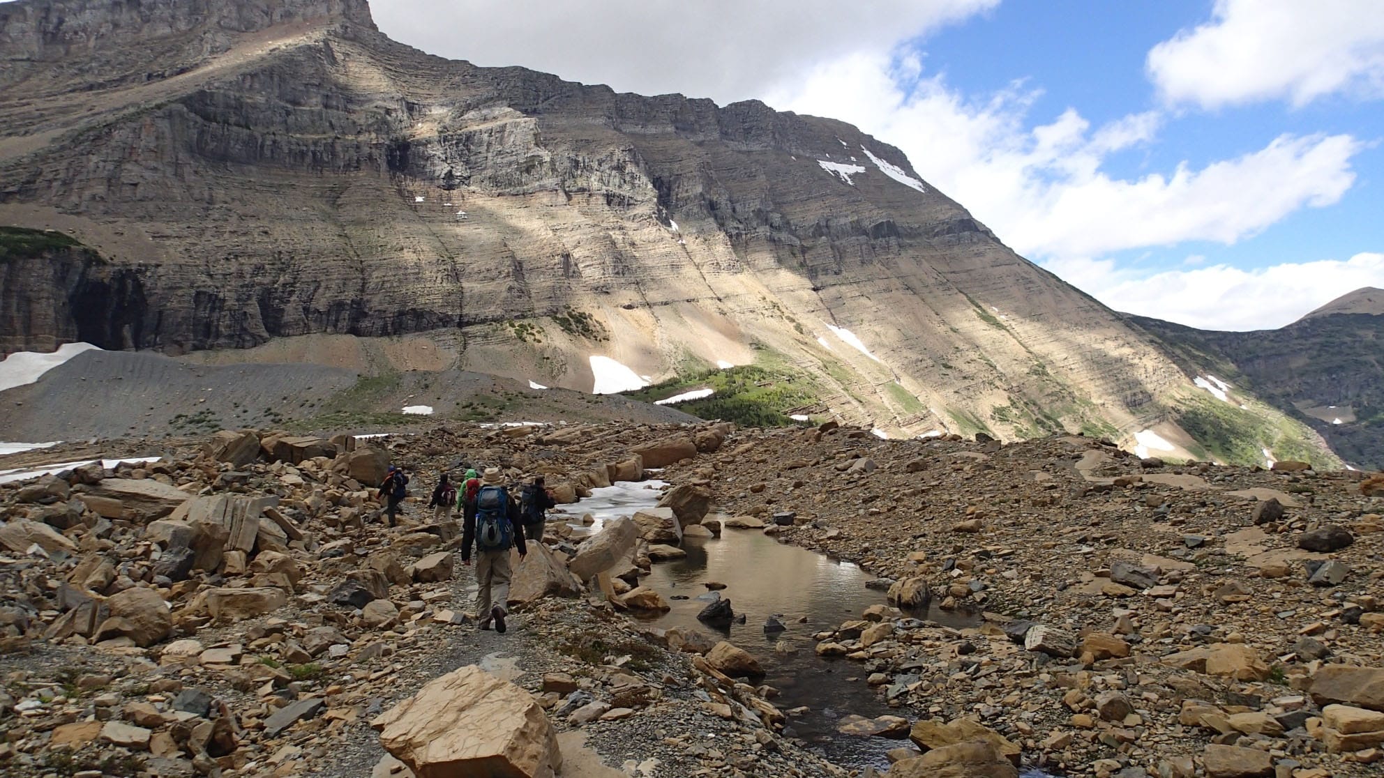
Geologists hiking through the high country of Glacier National Park
When: July 5 – August 5, 2022 (tentative)
Where: St. Paul/Minneapolis, Minnesota (introduction and lab work) and Glacier National Park, Montana (field work)
Who: Six students, and project leaders Dr. Kelly MacGregor (Macalester College, macgregor@macalester.edu) and Dr. Amy Myrbo (geoscience consultant).
Prerequisites and Recommended Courses: Because this experience is targeted for students early in their academic careers, there are no specific coursework prerequisites. We are seeking students who are interested in many or all of the following: limnology, geomorphology, glaciers, wildfires, human impacts to lake ecosystems, natural and manmade climate change, erosion and sedimentation, and using field and laboratory methods to explore scientific questions about earth surface processes.
Ideally, students will have some comfort with (or willingness to experience!) sharing close quarters in tents in cold and sometimes rainy weather, boating and swimming, communicating with the public and tourists ‘on the spot,’ hiking up to 12 miles in a day (typically 4-5 miles a day carrying heavy gear), and being without cell phone coverage for up to two weeks. Students will need to maintain composure in field conditions that are safe but that may include bad weather, difficult trail and boat conditions, and wildlife (including bears). Support in the form of field gear loans will be provided to students who do not own their own. All tents and cooking gear will be provided.
Expectations and Obligations:
- Participation in all project-related work during the summer (approximately July 5-August 5, 2022)
- Write a team abstract and present a paper (poster or talk) at the Geological Society of America National Meeting in Denver, CO, October 9-12, 2022 (all expenses covered).
- Enthusiasm, a willingness to work as a member of a team, and an ability to follow rules for the safety of the group!
PROJECT DESCRIPTION
This project utilizes the remote and relatively pristine landscape of Glacier National Park (GNP; the Park), Montana as a natural laboratory for understanding the impacts of climate change, both natural (e.g., glacial-interglacial cycles, Little Ice Age) and anthropogenic, on alpine landscapes. Understanding controls on past climate variability is key to assessing potential future environmental change. The climate history of the northern Rocky Mountains is known primarily from lacustrine paleoecological records that are widely spaced in Montana, Idaho, and Wyoming (e.g., Karsian, 1995; Doerner and Carrara, 1999; Millspaugh et al., 2000; Doerner and Carrara, 2001; Brunelle and Whitlock, 2003; Hofmann et al., 2006; Shapley et al., 2009). In 2005, 2010, 2014, and 2018 we collected lake cores in Swiftcurrent Lake, Lake Josephine, and lower Grinnell Lake, all of which are located downstream of Grinnell Glacier in the Many Glacier region of Glacier National Park, Montana (Figure 1). Work done on these cores by previous students (many of them as part of Keck projects) has provided additional constraints on climate and environmental history in the basin since the end of the Last Glacial Maximum. For example, a continuous core from Swiftcurrent Lake spanning ~17,000 years demonstrates a strong link between climate in the basin and solar forcing on centennial timescales (MacGregor et al., 2011), as well as links between glacier size and detrital dolomite in the lakes (Schachtman et al., 2015). A manuscript in preparation (including two Keck students as co-authors) explores the fire history of the region during the Holocene and demonstrates a link between fire frequency and increased geomorphic activity on the surrounding hillslopes. Another manuscript examines changes in the carbon signatures in lake sediment as a result of human activities in the Park over ~150 years.
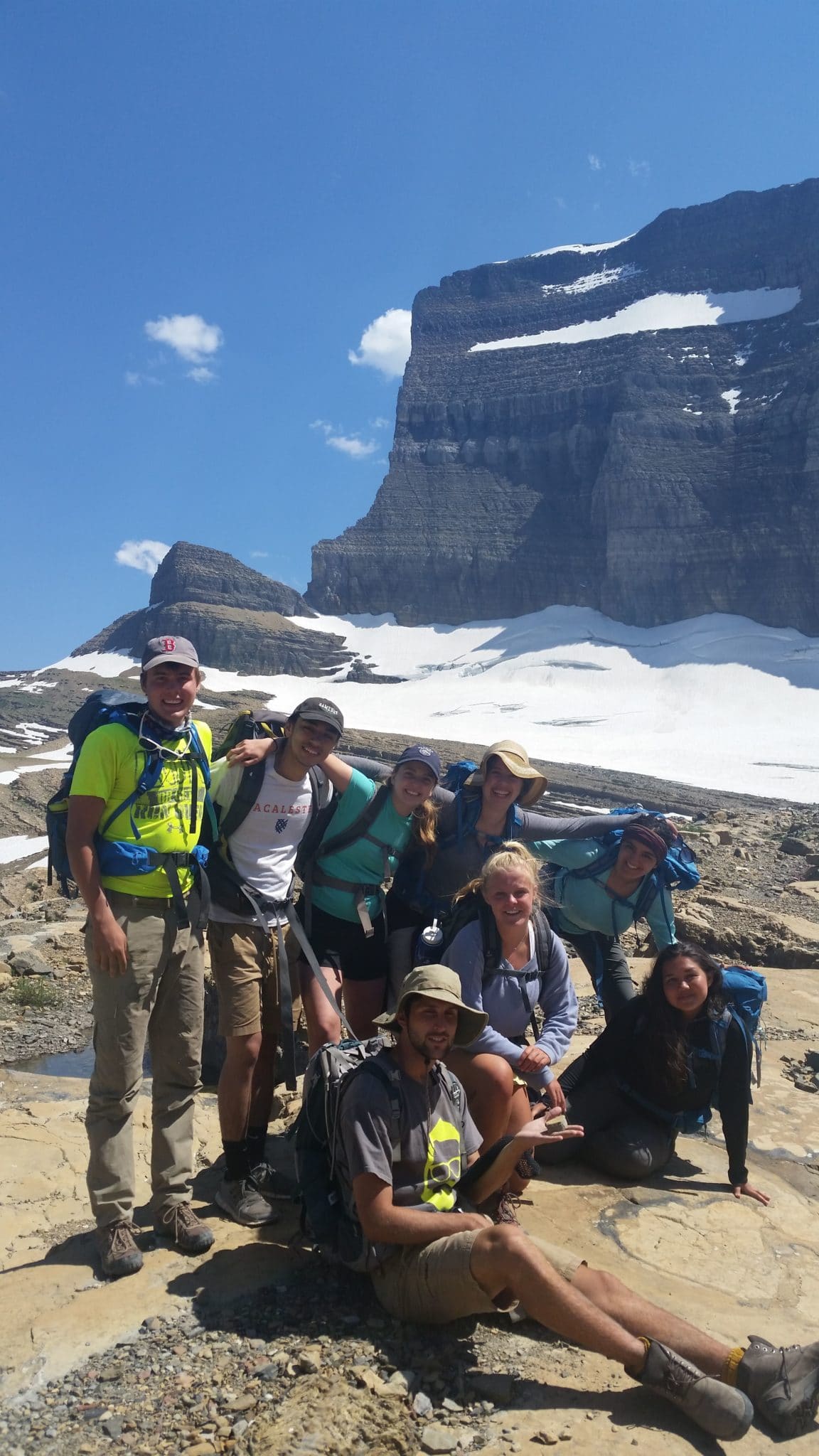
Figure 1: Photo of Gateway Keck students at Grinnell Glacier (in background), Glacier National Park, Montana (July 2018).
This year, our project will focus on the collection of a transect of several short (top ~100 cm of sediment at the lake bed) in Redrock Lake to understand environmental and landscape change over the past several centuries. These cores will allow us to: 1) provide enhanced spatial resolution of dolomite transport in the proglacial hydrologic system to enhance our understanding of the relationship between hillslope processes, glacial erosion, and lake transport and sedimentation; 2) measure the presence and concentration of charcoal in the lakes as a result of forest fires from summer 2017 and 2015 and compare the severity to Holocene fires; 3) assess the human impacts on the watershed through collection and dating of near-surface sediments; and 4) understand the hydrologic and sedimentologic transport of basin sediment in two contrasting geomorphic valley systems (one with deep glacial lakes and the other with primarily shallow paternoster lakes). We also plan to collect ground-penetrating radar data in Redrock and Fishercap lakes to understand depositional and desiccation history in lower Swiftcurrent Valley.
There is broad interest in the future of our National Park system, as well as the response of glaciers to climate change. Visitation in National Parks continues to grow each year, with record numbers in 2017 (https://e360.yale.edu/features/greenlock-a-visitor-crush-is-overwhelming-americas-national-parks). Glacier National Park is sensitive to climate change through glacial retreat (e.g., Key et al., 2002) and ecosystem adjustments (e.g., Klasner and Fagre, 2002), and there is widespread interest in the effects of future climate change in this unique and public space. This research project is aimed at understanding environmental and climate change in a near-pristine alpine basin in North America and will collect data relevant to the debate about the impacts of humans on remote landscapes. The research has relevance to communities in geomorphology, Quaternary geology, glaciology, and paleoclimatology, as well as to the general public interested in the impacts of climate change. At the same time, Indigenous people who lived in what is now the Park are asserting their rights and telling their own stories (https://www.hcn.org/articles/
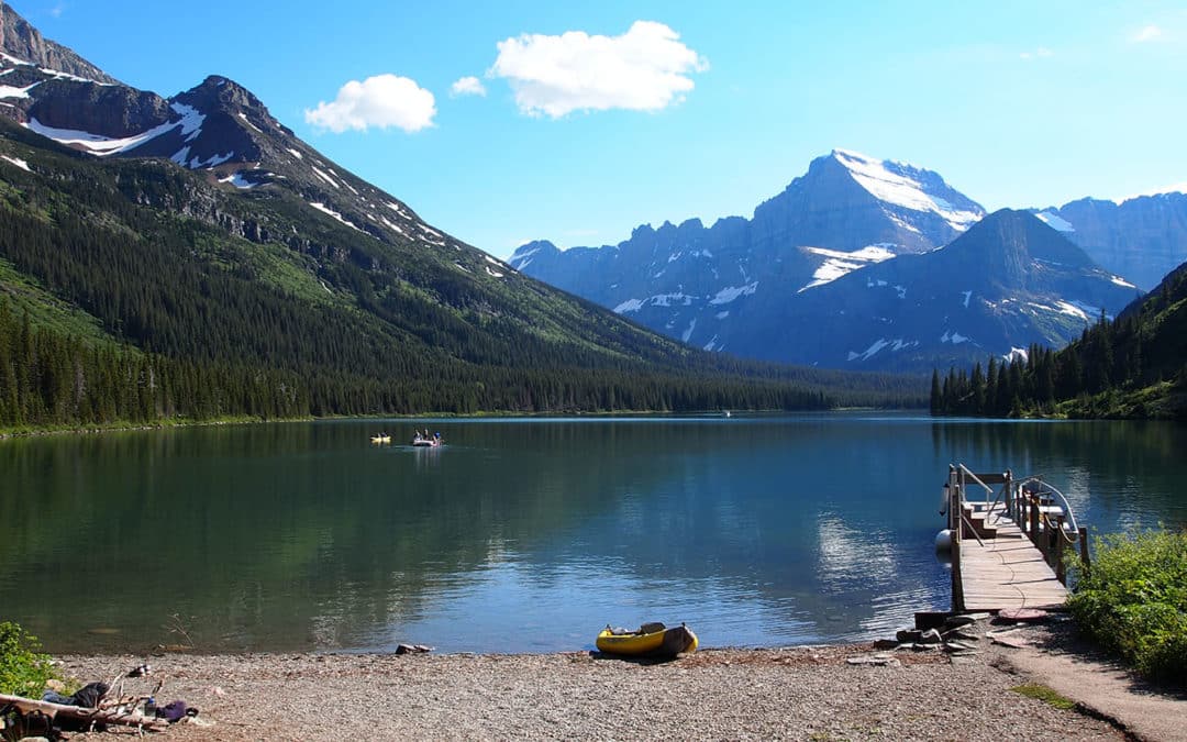
Study Area
The Many Glacier region of Glacier National Park in northwestern Montana has been our research site for the past 18 years. For the 2022 field season we will add the Swiftcurrent Valley and Redrock Lake to our ongoing research area of the adjacent Grinnell Valley. Glaciers that have diminished significantly since the 19th century occupy the heads of both of these valleys.
Learning Outcomes
- Students will gain foundational knowledge of: a) formation of sedimentary and intrusive igneous rocks, b) regional metamorphism and mountain building, c) climate variability during the Pleistocene, d) glacier dynamics and subglacial/supraglacial erosion, and e) sediment transport and deposition in glacial lake systems.
- Students will learn to read and interpret topographic and geologic maps, including locating themselves in the field.
- Students will learn to make measurements of active processes and collect samples with an understanding of WHY the data/results are important/interesting.
- They will learn how to explain the relevance of their research project to a variety of people (peers in the field, Park visitors, Park Rangers, peers at the national Geologic Society of America (GSA) meeting).
- Students will learn how to be an effective team member in the context of both the field and the laboratory.
- Students will learn about the scientific process, including the role of problem-solving, creativity, quantitative reasoning, and revision in science.
- Students will gain confidence in their abilities as a scientist, including working in the field and the lab.
- Students will be able to identify ways in which their own life affects (and is affected by) interactions with the Earth (Fink, 2003).
- Students will learn to situate the context of the Park in past and present Native American life and culture.
Research Plan and Student Projects
We have spent many summers in the past ~18 years conducting research with undergraduates in this region of Glacier National Park, including Keck projects in 2010 and 2014, and a Gateway Keck project in 2018. Early work focused on measuring ice dynamics and mass balance of Grinnell Glacier, located in the headwaters of Grinnell Glacier Valley. We have collected several long sediment cores in lower Grinnell Lake, Swiftcurrent Lake, and Lake Josephine in an effort to examine geomorphic and environmental change in the valley. In summer 2018 with 7 Gateway students and one near-peer mentor, we collected a transect of cores from Fishercap Lake and long cores in Swiftcurrent Lake. The results of this work was presented by the students at GSA in November 2018.
The primary research objectives for summer 2022 are to A) collect lake sediment cores in Redrock Lake, and B) collect ground-penetrating radar (GPR) in Redrock Lake and Fishercap Lake. The overarching goal is to better understand source areas for lake sediment, sediment accumulation rates and transport dynamics over the past ~5,000 years in Swiftcurrent Valley.
- By collecting lake cores, students will also be able to make comparisons of Redrock Lake sediment dynamics to those in nearby lakes in Grinnell Valley, and better understand dominant geomorphic processes operating in the two valleys. In addition to learning to collect cores in the field, students will learn to sample sediment cores for age controls (loss-on-ignition (LOI), charcoal radiocarbon, and cesium-137), and to plot and interpret GPR data in the laboratory. Comparing LOI along a lake transect can also provide data that reflect the amount of organic and inorganic carbon inputs into the lakes and how that varies in space and time. This speaks to both modern climate change and possibly human impacts on the Park landscape. Both cesium-137 and radiocarbon ages are key to interpreting rates of deposition in the lakes (both during the last few centuries and extending back to the pre-Younger Dryas period) and making comparisons to other cores. We note that our radiocarbon samples from the 2018 Gateway Keck Project were completed in time for the poster presentations at GSA.
- GPR data can be collected via instrumentation and receivers set up in kayaks and paddled around the lakes of interest. While we have collected bathymetric (lake depth) data in the past, we have yet to ‘image’ sediment below the lakebed, and we have not yet reached the sediment/bedrock interface in our coring due to equipment limitations. The use of GPR will allow us to ‘see’ the subsurface and better understand the accumulation in the lake post glacial retreat. This provides additional information about sediment transport and deposition in the lake and is tied directly to observations of sedimentation in the lake sediment cores.
Backup Research Plan
We recognize that there are situations that can alter research plans (i.e., weather, trail closures due to bears, forest fires, equipment malfunction, COVID, etc.), and we have ‘backup’ projects based on sediment cores we have already collected. This includes:
- Fire history and modern fire records: Large fires occurred within the Park boundary in 2015 and again in 2017 and 2018. With permission from the Park, we would like to sample from a lake more proximal to the 2017 Sprague fire (Fish Lake on the West Side on GNP near Lake McDonald). This will require additional permitting, which has already been submitted to the Park Service (final approval expected late March 2022). Even if we are not granted access, surface cores collected from other lakes in Grinnell Valley are highly likely to produce records of fires in the past several hundred years. Transects of charcoal records could illuminate transport of charcoal particles in high-relief alpine systems, which has not been the focus of previous research.
- Modern lake processes: Portable hydrolabs can measure dissolved oxygen, pH, turbidity, conductivity, temperature, and other metrics. Comparisons between glacier-fed and unglaciated lakes could be made, as well as comparisons of human-proximal and human-distal regions of the valley. In addition, students can make comparisons between measurables in GNP lakes and those in other alpine systems affected by climate change (e.g., Fink et al., 2016).
- Modern water and sediment fluxes: Measuring water discharge (using traditional USGS gaging methods) and suspended sediment concentrations (water filtering) were conducted at two lake inlets in summer 2018 as part of the Gateway Keck Project. We successfully collected interesting data but were unable to devote significant time to this monitoring; a more focused study of 3-4 lake inlets/outlets would provide constraints on sediment and water flux during the summer high flow season, and allow comparisons to historical sedimentation rates.
- If field work isn’t a viable option because of COVID and/or Park closures, laboratory research on existing cores at the Continental Scientific Drilling Facility (CSD) would be another option. This includes fire history, grain size reflecting energy of sediment transport, and grain mineralogy through XRD and SEM analysis.
PROJECT LOGISTICS
Our tentative dates are July 5-August 5, 2022.
Students will arrive in the Twin Cities and spend five to six days staying in the residence halls at Macalester College for classroom and laboratory ‘crash courses’ to prepare for the field work and their projects. These will include mini-lectures, hands-on activities, talks by faculty and researchers in the geosciences at the University of Minnesota (UMN) and Macalester, and training at the Continental Scientific Drilling Facility (CSD). We envision that most students will have taken no more than one geology course (perhaps none), and that the first several days will be devoted to activities, reading, lectures, and labs to introduce major Earth science concepts and the nature of scientific inquiry in geology. This includes the geologic evolution of GNP (sedimentary rock formation, igneous intrusions, mountain-building), global climate change (Pleistocene, Holocene, and recent), and surface processes (weathering and hillslopes, glacial erosion, fluvial transport). While many of these topics will be introduced during the beginning of the project, we expect student learning will continue during our travel and in the field as a foundation for their projects. We will make sure that all students are properly outfitted for field work (clothing, camping gear, water bottles, backpacks, etc.), and we will do preliminary grocery shopping as a group (including conversations about working, cooking, and living outdoors and in close quarters).
We will spend two days driving to Many Glacier (camping in Glendive, MT on the way out/back), and hope to camp at the NPS group campsite there. If we are unable to do so, we have cabin reservations inside the Park at Many Glacier. We plan to cook most meals in the campground during our ~12-14 days in the Park.
The first several days in the field will be spent learning about the geology, biology, and history of the Park, as well as reading about use conflicts between the Park and the Blackfoot Indian community in the region. We will watch a training video on bear safety at the Many Glacier Ranger Station and learn to safely hike and camp in the Park. We plan to travel and hike (up to 12 miles/day) in other parts of the Park, including Logan Pass (continental divide) and West Glacier (near the major 2017 & 2018 fires). Collection of lake cores and GPR will be conducted in small groups over the course of five to seven days. As we have done each summer working in the Park, the group will present our past findings and current projects to the Park Rangers during our stay. We anticipate daily interactions between students and the public, as has been our experience in past years conducting research in the Park. We hope to visit with one or more Indigenous scientists during our time in Montana.
After returning to the Twin Cities, we will again stay at Macalester (or a nearby Airbnb) and drive daily to the CSD facility at the University of Minnesota (four miles), where we will split, log, photograph, and archive the cores in accordance with standard limnogeological community procedures. Depending on the projects selected, we will spend the final week in the lab conducting analyses, completing blog posts and assessments, and the group will work together to submit abstracts for the annual GSA meeting in Denver, CO in October 2022.
GNP SAFETY ISSUES
MacGregor and Myrbo are experienced field scientists with experience in similar landscapes across the globe. They are familiar with safety issues specifically related to bears, alpine weather conditions, and boating. There is little question that there are a host of inherent risks in this proposed work, but we will try to minimize this risk through training, communication, assessment of student abilities, and planning. Here we briefly address the most common concerns.
Bears: We will spend the bulk of our field time camping in bear country, with large populations of both black and grizzly bears. Students will be trained by Park rangers in proper food storage and camping/hiking safety. Each team of students/researchers will carry pepper spray and travel in groups of 4-5 for the majority of the field work. Note that past projects have all encountered bears at a safe distance, as well as sightings of moose and even wolverines.
Boats: To collect samples of sediment and other physical measurements of lake water, we will be using non-motorized inflatable boats, including kayaks. Students are required to wear life jackets at all times, and the lakes are small enough in size that the shorelines are always visible. Students will always boat with at least one other person, with clear communication about the planned route and expected time on the water.
Weather/conditions: The weather in the Park can be quite unpredictable and variable, with some days up to 80° F and others at/near freezing temperatures. Heavy rain and wind, hail, and snow are all possible, as are very hot sunny days. Warm clothing and layers are all necessary, including rain gear. A day pack (medium sized backpack) is important for all students so they can carry sufficient clothing and food every day, including 2-3 large water bottles. Suncreen, winter hats and gloves, sunglasses, and sturdy hiking shoes/boots are key for student safety and comfort.
PROFESSIONAL DEVELOPMENT
Conducting a research project at an early career stage is not only a résumé-builder, but helps to develop many skills that are applicable after the summer is over. Working and living together in the field, collaboratively completing a project from start to finish, and starting to develop a network of friends and colleagues all build resiliency, capabilities, and cognitive abilities. This Gateway Keck project offers these experiences in a supportive yet challenging environment. Students will work on real scientific questions, using standard and state-of-the art field and lab equipment; they will also receive training in science communication, including informal interactions with the public in the field, and more formal methods of presenting information such as lightning talks and giving better, more engaging research presentations.
References
Anderson, H., MacGregor, K.R., Oddo, P., Riihimaki, C., Williams, C., Myrbo, A. (in prep). Little Ice Age and human impacts in eastern Glacier National Park, Montana, USA. Proceedings of the National Academy of Sciences.
Brunelle, A. and Whitlock, C., 2003. Postglacial fire, vegetation, and climate history in the Clearwater Range, northern Idaho, USA. Quaternary Research 60, 307-318.
Brunelle, A. et al., 2005. Holocene fire and vegetation along environmental gradients in the northern Rocky Mountains. Quaternary Science Reviews 24, 2281-2300.
Carrara, P.E., 1995. A 12000 year radiocarbon date of deglaciation from the Continental Divide of northwestern Montana. Canadian Journal of Earth Sciences 32, 1303-1307.
Carrara, P.E., 1993. Glaciers and glaciation in Glacier National Park, Montana. Open-File Report 93-510, 1-18.
Carrara, P.E., 1990. Surficial geologic map of Glacier National Park, Montana.1:100,000, .
Carrara, P.E., 1989. Late Quaternary and vegetative history of the Glacier National Park region, Montana.1902, 64 p.
Carrara, P.E., 1987. Holocene and latest Pleistocene glacial chronology, Glacier National Park, Montana. Canadian Journal of Earth Sciences 24, 387-395.
Craig, D.R., Yung, L., Borrie, W.T., 2012. “Blackfeet Belong to he Mountains”: Hope, Loss, and Blackfeet Claims to Glacier National Park, Montana. Conservation and Society, Vol. 10 (3), p. 232-242. DOI: 10.4103/0972-4923.101836
Doerner, J.P. and Carrara, P.E., 2001. Late quaternary vegetation and climatic history of the Long Valley area, west-central Idaho, U.S.A. Quaternary Research 56, 103-111.
Doerner, J.P. and Carrara, P.E., 1999. Deglaciation and postglacial vegetation history of the West Mountains, west-central Idaho, U.S.A. Arctic, Antarctic, and Alpine Research 31, 303-311.
Earhart, R.L. et al., 1989. Geologic maps, cross section, and photographs of the central part of Glacier National Park, Montana.
Fink, G., Wessels, M., Wuest, A., 2016. Flood frequency matters: Why climate change degrades deep-water quality of peri-alpine lakes. Journal of Hydrology 540, 457-468.
Hanauer, D.I., Graham, M.J., Hatfull, G.F. 2016. A Measure of College Student Persistence in the Sciences (PITS). CBE-Life Sci Educ vol. 15, no. 4, ar54. doi: 10.1187/cbe.15-09-0185CBE
Hofmann, M.H. et al., 2006. Late Pleistocene and Holocene depositional history of sediments in Flathead Lake, Montana; evidence from high-resolution seismic reflection interpretation. Sedimentary Geology 184, 111-131.
Horodyski, R.J., 1983. Sedimentary geology and stromatolites of the Mesoproterozoic belt
Supergroup, Glacier National Park, Montana. Precambrian Research 20.
Karsian, A.E., 1995. A 6800-year vegetation and fire history in the Bitterroot Mountain Range, Montana. MSc. Thesis, University of Montana, Missoula. 54 p.
Key, C.H., D.B. Fagre, R.K. Menicke. 2002. Glacier retreat in Glacier National Park, Montana. In R.S. Williams and J.G. Ferrigno, eds., Satellite image atlas of glaciers of the world: North America. U.S. Geological Survey Professional Paper 1386-J, U.S. Government Printing Office, Washington D.C. p 365-381.
Klasner, F. L. and D. B. Fagre. 2002. A half century of change in alpine treeline patterns at Glacier National Park, Montana, U.S.A. Arctic, Antarctic, and Alpine Research. 34(1):53-61.
MacGregor, K.R., Riihimaki, C.A., Myrbo, A., Shapley, M.D., Jankowski, K. 2011. Geomorphic and climatic change over the past 12,900 years at Swiftcurrent Lake, Glacier National Park, Montana. Quaternary Research, 75(1), doi:10.1016/j.yqres.2010.08.005.
MacLeod, D.M. et al., 2006. A record of post-glacial moraine deposition and tephra stratigraphy from Otokomi Lake, Rose Basin, Glacier National Park, Montana. Canadian Journal of Earth Sciences 43, 447-460.
Mehringer, P.J.,Jr et al., 1984. The age of Glacier Peak tephra in west-central Montana. Quaternary Research 21, 36-41.
Millspaugh, S.H. et al., 2000. Variations in fire frequency and climate over the past 17 000 yr in central Yellowstone National Park. Geology 28, 211-214.
Schachtman, N., MacGregor, K.R., Myrbo;, A. Hencir, N.R., Riihimaki, C.A., Thole, J., Bradtmiller, L. (2015). Lake core record of Grinnell Glacier dynamics during the Late Pleistocene and Younger Dryas, Glacier National Park, Montana, U.S.A. Quaternary Research, v. 84, no. 1, p. 1-11, doi:10.1016/j.yqres.2015.05.004
Shapley, M.D. et al., 2009. Late glacial and Holocene hydroclimate inferred from a groundwater flow-through lake, northern Rocky Mountains, USA. The Holocene.
Whipple, J.W., 1992. Geologic map of Glacier National Park, Montana.1:100,000.