Using the geochemistry of sediments (and metasediments) as windows into the evolution of ancient and modern mountain ranges
Overview: As plates subduct and continents collide, mountains are formed. There are many ways to study mountains; we will focus on the histories that are preserved in the chemistry of sediments shed from them as they grow. One group of students will study how different regions of the Patagonian Andes grew over the last 66 million years by analyzing uranium and lead isotopes in the mineral zircon. As mountains evolve from tectonics, magmatism, and climate, rivers transport shedded sediment from the mountains to downstream areas, sedimentary basins. Thus, sedimentary basins provide a history of past tectonics, magmatism, and climate. We will analyze the ages of the mineral zircon and individual grains of sand (now rock) within the basin to investigate which parts of the mountains contributed sediment. Identifying the source of zircons and sand grains will allow us to determine how these forces have shaped the Patagonian Andes.
A second group of students will focus on a much older range of mountains, the Adirondacks of New York state. Over a billion years ago, the Adirondack region was much like the Andes mountains are today, a continental subduction zone, shedding sediments as mountains grew. Approximately one billion years ago, the subduction zone was sealed by a massive continental collision, burying sediments deeply, heating, metamorphosing them, and even causing them to partially melt. We will analyze the chemistry of the metamorphic minerals using a Scanning Electron Microscope, making maps that show the different concentrations of elements. We will then use image analysis to use those maps to estimate the pressures and temperatures of metamorphism of the sediments, which will help to constrain the structure of the ancient mountain range. Together, both groups will explore key aspects of geology, including plate tectonics, mineral chemistry, isotopic dating and deep time by “doing” science. We will learn more about what it is to major in geology, and about many different career paths of geology majors by meeting with a variety of recent (and not so recent) geology grads.
When: July 5 – August 6, 2021
Where: Virtual, based at Oberlin College, Oberlin, Ohio. We anticipate the project to involve Zoom meetings for coordination, learning, and team-building. We will analyze shared datasets and operate instrumentation via remote control. Should the COVID-19 situation change substantially, the latter part of the project may be in person and include a field trip to an ancient orogeny (the Adirondack Mountains). This possibility is dependent on updated COVID-19 policy at Oberlin College.
Who: Eight rising sophomores and project leaders: Dr. Zeb Page (zpage@oberlin.edu) and Dr. Rebecca VanderLeest (rvanderl@oberlin.edu), Oberlin College
Prerequisites and Recommended Courses: Enthusiasm to learn about new ways to study our planet. Willingness to learn to problem solve with geochemical data and accept possibly ambiguous results.
Expectations and Obligations:
- Willingness and enthusiasm to participate in an intensive, 5-week remote experience.
- An interest in teamwork and building connections with new people.
PROJECT DESCRIPTION
Young Mountains: The Patagonian Andes
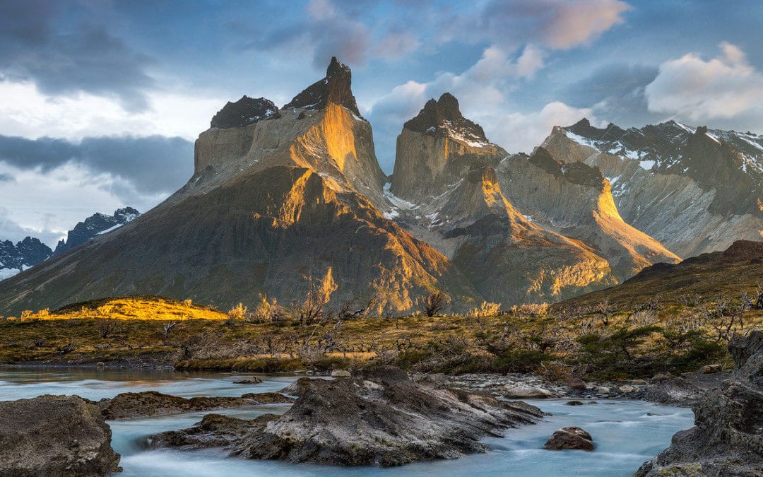
Mountains are modified over time via exhumation, erosion, and climate. Archives of past orogenic modification are recorded in the adjacent foreland basin. Provenance studies of the foreland basin examine these archives to recognize where sediment is being derived and what the origin reveals about past tectonic and magmatic activity. The Magallanes-Austral Basin, located at the southern tip of South America (Fig. 1), provides an excellent example of continuous stratigraphic section (e.g., Biddle et al., 1986; Romans et al., 2010; Daniels et al., 2018; Fosdick et al., 2020) from which provenance studies can be conducted to study past tectonic and magmatic activity. Further, this basin underwent several tectonic changes including episodes of ridge subduction (Ramos and Kay, 1992; Ramos, 2005), thrust belt advancement (Fosdick et al., 2011), and opening of oceanic passageways (Eagles and Jokat, 2014), which may be recorded in the sediment archives.
Detrital zircon ages have proven diagnostic when determining sediment sources for the southern Patagonian Andes (Fig. 2) (e.g., Schwartz et al., 2016; Leonard et al., 2020; Fosdick et al., 2020). Currently, Cenozoic-based provenance studies using modal sandstone analysis, clast counts, and detrital zircon ages reveal that Oligocene-Miocene fluvial sediment is dominantly sourced from the volcanic arc despite increased fold and thrust belt activity during this time in the Cerro Castillo area (Leonard et al., 2020; VanderLeest et al., 2020). Comprehensive detrital zircon ages from Cenozoic stratigraphy within Cerro Castillo reveal loss of Paleozoic and Jurassic sources throughout the Cenozoic due to Paleogene orogenesis and rise of Cretaceous sources due to fold and thrust belt activity (Fosdick et al., 2020). North of Cerro Castillo in Sierra Baguales, comprehensive provenance analysis has not been conducted. Further, stratigraphy of the Sierra Baguales displays differences in grain size and fossil content (Ugalde et al., 2018) when compared to Cerro Castillo, and basin subsidence histories reveal slight differences in patterns of tectonic uplift (VanderLeest, 2020). These differences could signal changes in basin geometry which may reflect tectonic and magmatic differences within the Patagonian Andes between these study areas. A provenance study that captures how Cenozoic tectonics has influenced Sierra Baguales and Cerro Castillo areas would provide a more holistic view of the Ultima Esperanza region.

In 2017, detrital zircon U-Pb ages, modal sandstone and clast counts were completed for the Sierra Baguales and Cerro Castillo study areas. A total of 10 detrital zircon samples were collected from the Paleogene to Miocene section at Sierra Baguales and 10 detrital zircon samples collected from Paleogene to Miocene sections at Cerro Castillo and Cancha Carrera. Along with a total of 40 sandstone petrographic thin section samples and clast counts between the two study areas. We will analyze the detrital zircon age populations and geochemistry along with the modal sandstone and clast count datasets to determine origin of the sediment and unravel tectonic and magmatic phases within the Ultima Esperanza region of the Patagonian Andes to understand differences between these two study areas.

Potential Student Projects
Students will work as a team to collaboratively analyze and synthesize detrital zircon ages and geochemistry and modal sandstone and clast counts, and relate analyses to paleoenvironmental and tectonic changes within the Patagonian Andes.
Project 1: Provenance characterization from detrital zircon populations. Two rising sophomores will work together on the statistical analysis of detrital zircon ages and geochemistry. This aspect of the project will involve downloading and organizing detrital zircon datasets from multiple formations within the study area (> 10), calculating cumulative and relative probabilities, performing K-S tests, and multidimensional scaling. Students will compare detrital age spectra between study areas and focus on how trends reflect tectonic and paleogeographic changes within the region.
Project 2: Provenance characterization from modal sandstone analysis. Two rising sophomores will work together on the statistical analysis of modal sandstone and clast count datasets. This aspect of the project will involve compiling and creating multiple QFL charts. Students will compare modal sandstone and clast count datasets from normalized upsection trends. Students will compare modal sandstone and clast count datasets between study areas and focus on how trends reflect tectonic and paleogeographic changes within the Patagonian Andes.
Ancient Mountains: The Adirondacks
The Adirondack Mountains of New York are a fragment of the exposed core of a massive, worldwide mountain building event, known as the Grenville Orogeny. The geology of the Adirondacks is notoriously complex, and records multiple episodes of subduction, collision and igneous intrusion from 1.3 to 1.05 Ga (e.g., Heumann et al., 2006). Sedimentary basins formed along the margin of the Laurentian continent, including detrital zircons similar to those being studied in the “Young Mountains” project (e.g., Chiarenzelli et al., 2015), which were heated to the point of partial melting during the collisional episodes, growing new zircon that dates the metamorphism (e.g., Heumann et al., 2006; Bickford et al., 2008). In addition to growing new zircon, metamorphic minerals such as biotite and garnet formed, the chemistry of which can be used to determine the conditions of metamorphism.
The study of metamorphism in the Adirondacks has been ongoing for more than a century. The first widespread application of a modern thermodynamic approach to the study of metamorphism established high temperatures (>700˚C) across the Adirondack Highlands with the highest temperatures found in the center of the region (Bohlen et al., 1985). More recent work focussed on metamorphosed igneous rocks have established peak temperatures of up to 850˚C (Spear and Markussen, 1997). Oxygen isotope studies in the Adirondacks have likewise confirmed high regional temperatures (e.g., Peck and Valley, 2004; Quinn et al., 2016), as well as the sedimentary origin of the partially-melted rocks known as migmatites (Lancaster et al., 2008). Recent work on a small number of these partially-melted metasediments has also resulted in extremely high temperature estimates (Storm and Spear, 2005; 2009).
Approaches to extracting temperatures and pressures from metamorphic rocks have evolved with changing technologies, and the previous paragraph cites studies using a variety of techniques. A fairly recent development in metamorphic petrology has been the use of internally calibrated X-ray composition maps to generate clouds of P-T data to better evaluate the information preserved in the chemistry of zoned minerals. We propose to use this approach (with the free software package XMap Tools, Lanari et al., 2014) to evaluate the P-T record of Adirondack metasediments, contributing to the dataset that can be used to reconstruct the geometry of this ancient mountain range.
Potential Student Projects
Page has a substantial collection of Adirondack samples at Oberlin College, including many migmatitic metasediments. After an initial orientation period, including virtual field trips and a literature review, students will choose from among the samples for their thermobarometry project. We anticipate four students working in pairs on two samples. Participants will learn to operate Oberlin’s SEM via remote control, and collect long-duration X-ray maps and point analyses to process with XMap Tools. In addition to analytical techniques via SEM/EDS, students will learn about concepts such as solid solution and thermobarometry. XMap tools offers a new approach to evaluating chemical zoning and its effects on thermobarometry that is well-suited to Gateway-level students. Because the software package includes mineral formula calculation and graphing abilities as well as built-in thermobarometers, novice students can focus on the meaning behind the data rather than getting bogged down with data manipulation and multiple software packages.
Active learning of foundational geology/geochemistry concepts
Students in the Gateway Project may come to the group with varying degrees of geology training, and we recognize that many may only have taken a single, introductory course (or may have had no geology at all). Furthermore, experience shows that many students come to geochemical research with uneven quantitative skills…perhaps most notably in the use of spreadsheets for calculations and data management. Thus, we plan to spend a substantial portion of the first 2.5 weeks of the program reviewing specific aspects of introductory geology and quantitative skills. We will do this through online labs and perhaps virtual field trips to local sites of interest. A typical morning in the first phase of the project might be spent doing the classic plate tectonics map jigsaw exercise, reviewing metamorphic minerals, or building a conceptual model of isotopic decay. The afternoon would include time operating the electron microscope remotely analyzing traverses of zoned garnet by EDS, or learning/reviewing how to use a spreadsheet program to process those data. Over the five weeks of the project we anticipate moving from introductory-level exercises, to processing isotopic data or compositional X-ray maps, to drafting figures.
Considerations for a remote project
We recognize the need to ensure that the entire team can work together and be a cohesive unit, but we also acknowledge substantial “Zoom fatigue” and the need to balance different types of activities, including some independent time offline. The inquiry based geology activities we describe above will be one major way that we support team building. We will need to continue to think deeply about ways to build group cohesion virtually. Trivia nights and virtual movie watch parties will need to be balanced with opportunities for students to log off and spend time away from the computer.
Learning Outcomes
Through both introductory educational projects and the research component, students will:
- Understand the scientific method as applied to geology: Students will learn how geologists approach problems in a systematic fashion. In close collaboration with faculty and mentors, students will learn how faculty went about setting up the problems they are studying. We will provide virtual trips to the field areas and discuss how to make sampling plans, and fill students in on the physical work of sample preparation and analysis that took place prior to the project.
- Learn analytic data analysis techniques: Students will learn to make thin sections, use optical and electron microscopy to describe metamorphic rocks, analyze major element compositions by Energy Dispersive Spectrometry, and reduce and interpret U-Pb isotopic data. Members of each research team will brief others on their projects and what they have learned.
- Understand science ethics/responsible conduct of research: As an NSF-funded project, students will be required to complete an online course in responsible conduct of research. In addition, students and faculty will have regular conversations about what it means to be an ethical researcher. We will cover topics such as making data available, co-authorship, honesty, and plagiarism.
- Strengthen communication skills: Students will gain skills in professional communication. Written communication for a scientific audience will be improved through the process of writing GSA abstracts. Graphical and oral communication will be improved through preparing and presenting a poster at GSA.
- Enhance knowledge about geoscience/environmental careers: Students who have not yet declared an interest in geology as a career may be more interested in geology if they have a clear idea of what career options are available. We plan to invite several recent alums and friends to talk about different career options in the geosciences via Zoom.
Project Logistics
Students will virtually be introduced to the research cohort and then, divided into groups based on their selected project. The first week will be spent in the “classroom” where students will be introduced to their respective project (ancient or existing subduction zones) through interactive lectures, discussions, and “visits” to various laboratories. The next week students will be walked through data reduction, and they will have access to their respective datasets. The following three weeks will be spent on synthesis and compiling an abstract and poster for associated conferences. Specialized software (Isoplot excel plug in, XMap Tools, Adobe Illustrator) will be accessible to students through virtual computer labs hosted at Oberlin.
COVID permitting, week 2 will be devoted to a 5-day field trip to the Adirondacks to introduce the students to subduction zones and aspects that impact foreland basin settings.
Safety: For the most part we anticipate students being in their own homes. Should a meeting in New York prove possible, in addition to standard field trip safety planning, the field trip will be compliant with Oberlin College’s current COVID-19 protocols.
References
Young Mountains
Biddle, K.T., Uliana, M.A., Mitchum, R.M., Fitzgerald, M.G., Wright, R.C., 1986, The stratigraphic and structural evolution of the central and eastern Magallanes Basin, southern South America. In: In: Allen, P.A., Homewood, P. (Eds.), Foreland Basins 8. Blackwell Publishing Ltd, Oxford, UK, pp. 41–61. https://doi.org/10.1002/ 9781444303810.
Fosdick, J.C., Grove, M., Graham, S.A., Hourigan, J.K., Lovera, O., Romans, B.W., 2015, Detrital thermochronologic record of foreland burial heating, sedimentary provenance, and orogenesis in Patagonia: Basin Res. 27, 546–572, https://doi.org/10. 1111/bre.12088.
Daniels, B.G., Auchter, N.C., Hubbard, S., Romans, B.W., Matthews, W.A., Stright, L., 2018, Timing of deep-water slope-evolution constrained by large-n detrital and volcanic ash zircon geochronology, Cretaceous Magallanes Basin, Chile: Geol. Soc. Am. Bull 130, 438–454.
Fosdick, J.C., VanderLeest, R.A., Bostelmann T., J.E., Leonard, J.S., Ugalde, R., Oyarzún, and Griffin, M., 2020, Revised timing of Cenozoic Atlantic incursions and changing hinterland sediment sources during southern Patagonian orogenesis: Lithosphere.
Leonard, J.S., Fosdick, J.C., VanderLeest, R.A., 2020, Dynamics of coupled surface and tectonic evolution of a retroarc orogenic wedge as revealed by sedimentary provenance: Front. Earth Sci. 7, 1–20. https://doi.org/10.3389/feart.2019.00353.
Ramos, V.A., Kay, S.M., 1992, Southern Patagonian plateau basalts and deformation: Backarc testimony of ridge collisions: Tectonophysics 205, 261–282.
Ramos, V.A., 2005, Seismic ridge subduction and topography: Foreland deformation in the Patagonian Andes: Tectonophysics 399, 73-86.
Romans, B.W., Fildani, A., Graham, S.A., Hubbard, S.M., Covault, J.A., 2010, Importance of predecessor basin history on the sedimentary fill or a retroarc foreland basin: Provenance analysis of the Cretaceous Magallanes basin, Chile (50-52 °S): Basin Res. 22, 640–658. https://doi.org/10.1111/j.1365-2117.2009.00443.x.
Schwartz, T.M., Fosdick, J.C., Graham, S.A., 2016, Using detrital zircon U-Pb ages to calculate Late Cretaceous sedimentation rates in the Magallanes-Austral basin, Patagonia: Basin Res. 29, 725–746. https://doi.org/10.1111/bre.12198.
Ugalde, R., Bostelmann, E., Fosdick, J., Alarcón, M., Oyarzún, J.L., 2018, Lithostratigraphy of the Cenozoic sedimentary series of Sierra Baguales, Magallanes, Chile: Actas digitales XV Congreso Geológico Chileno, Concepción, Chile.
VanderLeest, R.A., 2020, Detrital geothermochronology, geochemistry, and subsidence analysis of tectonics and sedimentation in the Magallanes-Austral Basin, Patagonian Andes [PhD Dissertation], 276 p.
VanderLeest, R.A., Fosdick, J.C., Leonard, J.S., Morgan, L.E., 2020, Detrital record of the late Oligocene – early Miocene mafic volcanic arc in the southern Patagonian Andes (~51°S) from single-clast geochronology and trace element geochemistry: Journal of Geodynamics 138, doi: 10.1016/j.jog.2020.101751.
Old Mountains
Bickford, M.E., Mclelland, J.M., Selleck, B.W., Hill, B.M., and Heumann, M.J., 2008, Timing of anatexis in the eastern Adirondack Highlands: Implications for tectonic evolution during ca. 1050 Ma Ottawan orogenesis: Bulletin of the Geological Society of America v. 120, p, 950.
Bohlen, S., Valley, J.W., and Essene, E.J., 1985, Metamorphism in the Adirondacks. I. Petrology, Pressure and Temperature: Journal of Petrology
Chiarenzelli, J., Kratzmann, D., Selleck, B.W., and Delorraine, W., 2015, Age and provenance of Grenville supergroup rocks, Trans-Adirondack Basin, constrained by detrital zircons: Geology v. 43, p, 183–186.
Heumann, M.J., Bickford, M.E., Hill, B.M., Mclelland, J.M., Selleck, B.W., and Jercinovic, M.J., 2006, Timing of anatexis in metapelites from the Adirondack lowlands and southern highlands: A manifestation of the Shawinigan orogeny and subsequent anorthosite-mangerite-charnockite-granite magmatism: Bulletin of the Geological Society of America v. 118, p, 1283.
Lanari, P., Vidal, O., De Andrade, V., Dubacq, B., Lewin, E., Grosch, E.G., and Schwartz, S., 2014, XMapTools: A MATLAB©-based program for electron microprobe X-ray image processing and geothermobarometry: Computers & Geosciences v. 62, p, 227–240.
Lancaster, P.J., Fu, B., Page, F.Z., Kita, N.T., Bickford, M.E., Hill, B.M., Mclelland, J.M., and Valley, J.W., 2008, Genesis of metapelitic migmatites in the Adirondack Mountains, New York: Journal of Metamorphic Geology v. 27, p, 41–54.
Peck, W.H., and Valley, J.W., 2004, Quartz-garnet isotope thermometry in the southern Adirondack Highlands (Grenville Province, New York): Journal of Metamorphic Geology v. 22, p, 763–773.
Quinn, R.J., Kitajima, K., Nakashima, D., Spicuzza, M.J., and Valley, J.W., 2016, Oxygen isotope thermometry using quartz inclusions in garnet: Journal of Metamorphic Geology v. 35, p, 231–252.
Spear, F.S., and Markussen, J.C., 1997, Mineral zoning, PTXM phase relations, and metamorphic evolution of some Adirondack granulites, New York: Journal of Petrology v. 38, p, 757.
Storm, L.C., and Spear, F.S., 2005, Pressure, temperature and cooling rates of granulite facies migmatitic pelites from the southern Adirondack Highlands, New York: Journal of Metamorphic Geology v. 23, p, 107–130.
Storm, L.C., and Spear, F.S., 2009, Application of the titanium-in-quartz thermometer to pelitic migmatites from the Adirondack Highlands, New York: Journal of Metamorphic Geology v. 27, p, 479–494.